Rare Winter Storm Threatens Over 130 Million

A rare winter storm is expected to impact parts of the South, Midwest, and Northeast starting Friday and into the weekend, bringing a combination of snow, sleet, and freezing rain to areas that typically do not experience wintry precipitation. A surge of cold Arctic air will slide southward late Friday into Saturday, setting the stage for temperatures to fall below freezing across much of the region just as moisture moves in from the west. Winter storm watches and warnings have been issued in advance of this winter storm with varying totals.
Meteorologist Patrick Crawford spoke with the National Weather Service in Little Rock Arkansas, about this upcoming winter storm.
SETUP
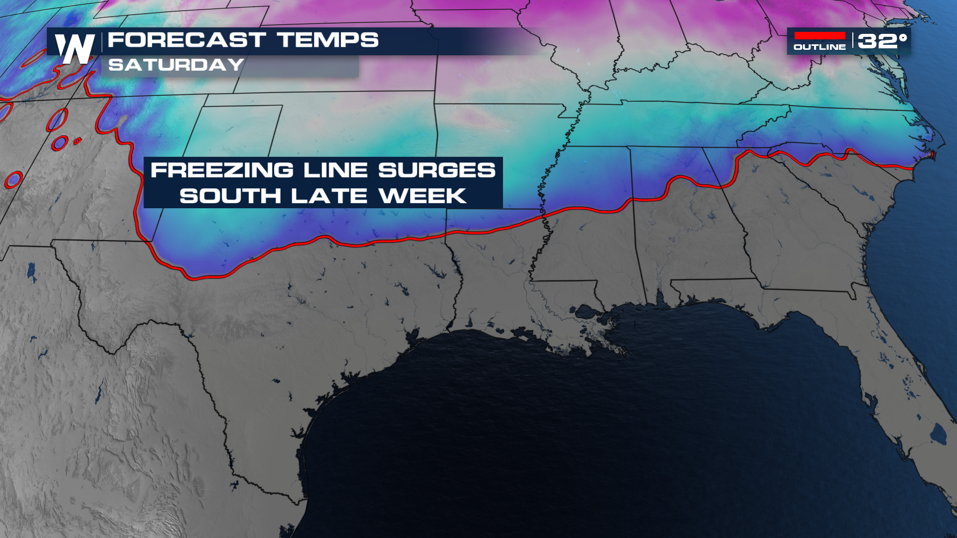
Air that's normally locked up around the poles looks to break off from the region. From there, it will slide southward, invading the southern states. Sub-freezing temperatures will settle in behind this Arctic front, potentially as early as Friday. At the same time, a disturbance will roll onshore from Baja California, providing the lift and moisture needed to cause problems.
TIMING
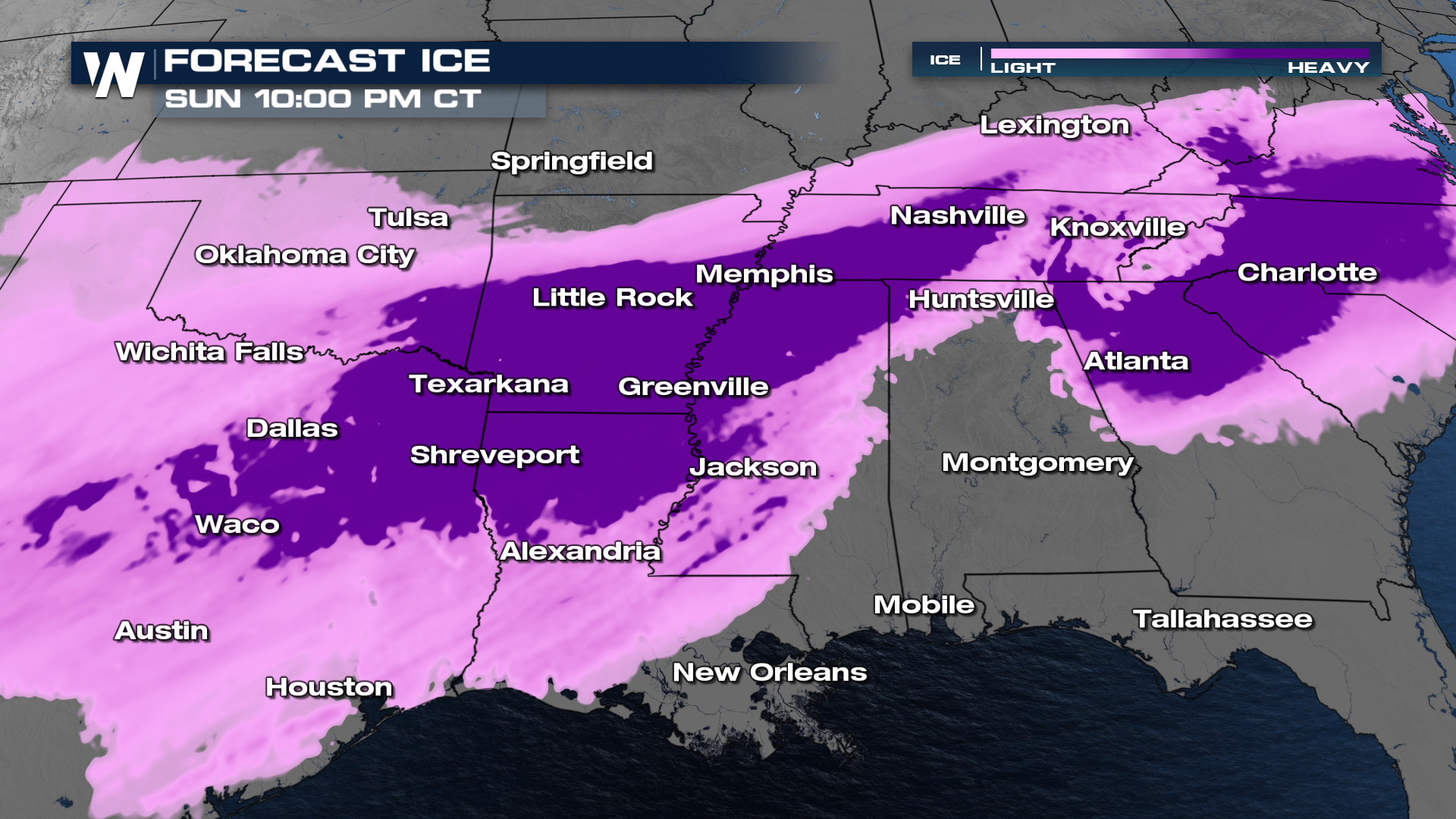
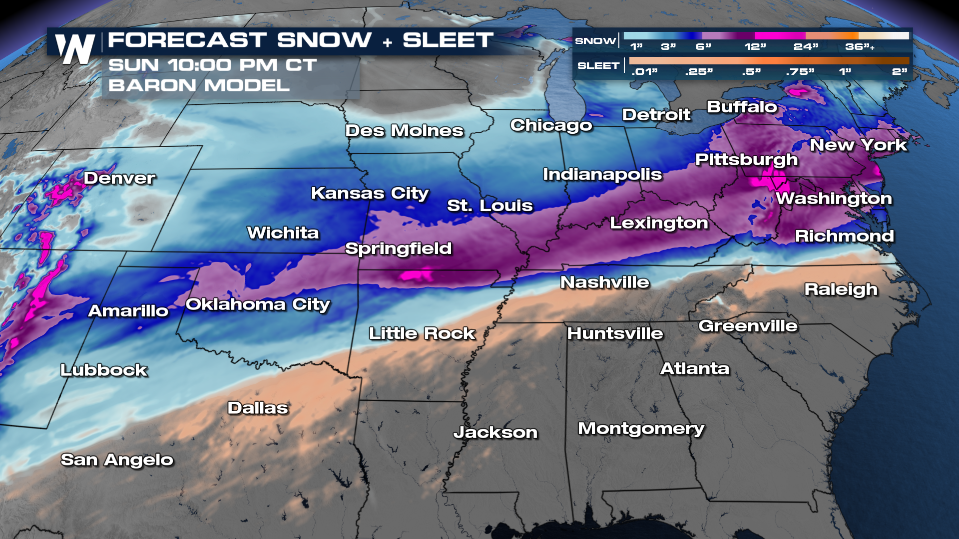
As the system develops, light to moderate precipitation is expected to overspread the area, with the exact type depending on surface temperatures and the depth of the cold air. Some locations may experience snow at the onset, while others will transition quickly to sleet or freezing rain. Even small amounts of ice could create hazardous travel conditions, especially on bridges, overpasses, and untreated roadways. Models have been inconsistent about pushing the cold air in, with some as early as Friday morning. If that pans out, the Friday evening's commute could be in some trouble. Saturday feels like a safer bet to see trouble, especially in the morning.
SNOW, ICE, AND SLEET TOTALS
The totals of snow and ice are the trickiest part of this forecast. Some models have over a foot of snow, and many models have up to half an inch of ice accumulating. Where the freezing line is will determine your type of precipitation.
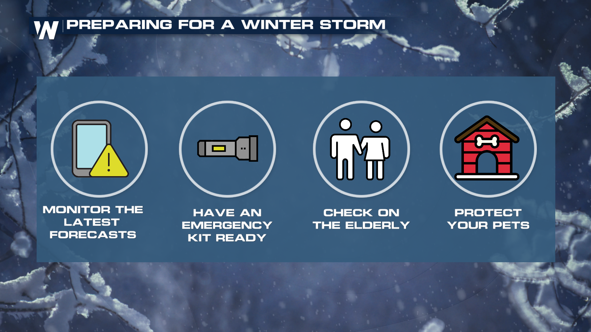
WHAT YOU SHOULD DO
Because snow and ice are uncommon across the Deep South, impacts can be significant even with minimal accumulation. Power outages are possible where ice builds up on trees and power lines, and travel disruptions could occur as drivers encounter slick roads. Residents are encouraged to monitor the forecast closely, limit travel if possible, and take precautions to protect people, pets, and property from the cold. With this storm likely not moving in until at least Friday afternoon, there is plenty of time to prepare. Know what your plans are on Friday and if they are negotiable. Make sure you stay tuned to WeatherNation for all the latest info on what you can expect towards the end of this week.